Back to services
MAP ARCHIVE

Sample Maps

A selection of maps we have produced for clients: claim and tenure maps, land title and permit maps, geology, LiDAR, spectral analysis and 3D models. Click any map to view it full size.

SHEETS
11
MAP TYPES
02
REGIONS
05
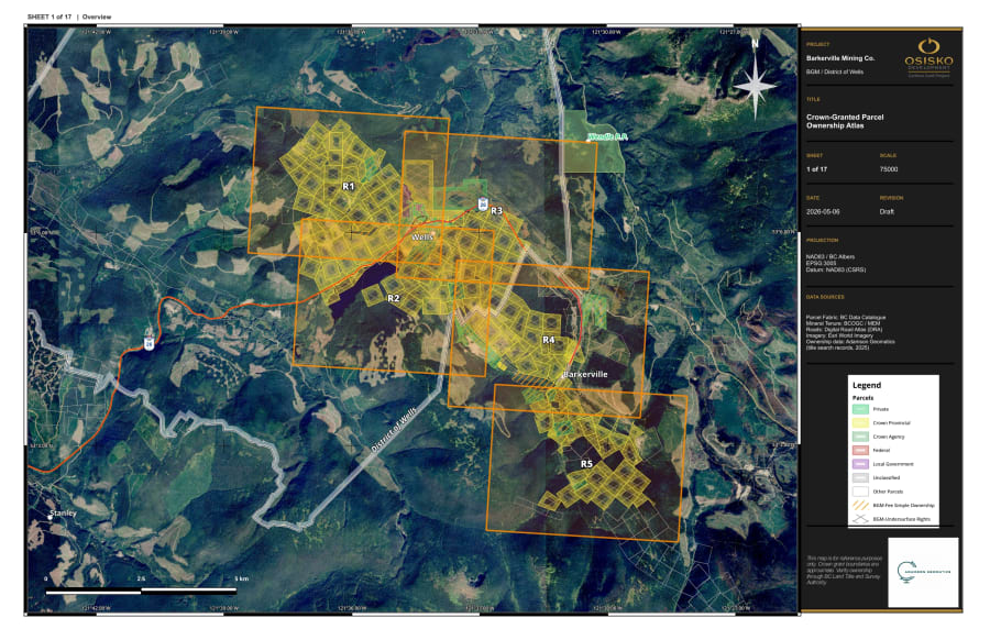
Barkerville Gold Mines Tenure & Ownership Map — OverviewView full size
SHEET 01/11
Mining Claim & Tenure

Barkerville Gold Mines Tenure & Ownership Map — Overview

Wells / Barkerville, Cariboo Region, British Columbia

Land tenure and ownership map of the Barkerville Gold Mines property near Wells and Barkerville, B.C. Sheet 1 of 5: overview of the land package.

View full size
View project
Barkerville Gold Mines Tenure & Ownership Map — Sheet 2View full size
SHEET 02/11
Mining Claim & Tenure

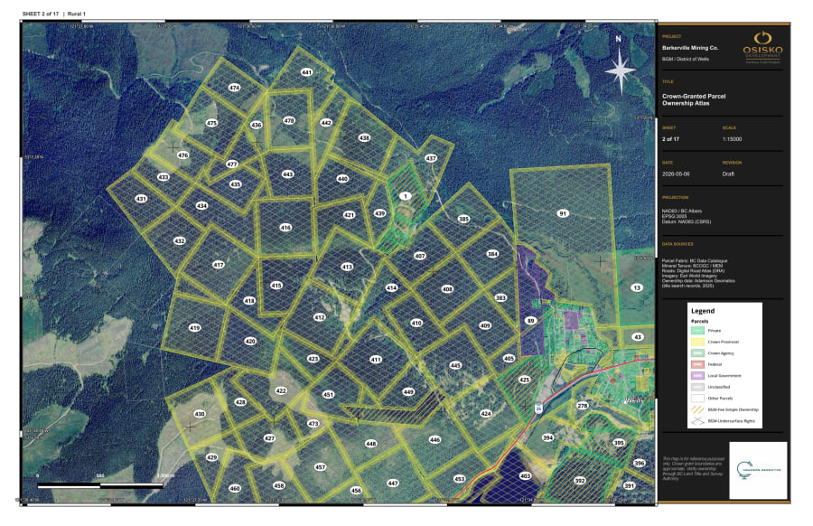
Barkerville Gold Mines Tenure & Ownership Map — Sheet 2

Wells / Barkerville, Cariboo Region, British Columbia

Detail sheet 2 of 5 of the Barkerville Gold Mines tenure and ownership map set, Wells / Barkerville, B.C.

View full size
View project
Barkerville Gold Mines Tenure & Ownership Map — Sheet 3View full size
SHEET 03/11
Mining Claim & Tenure

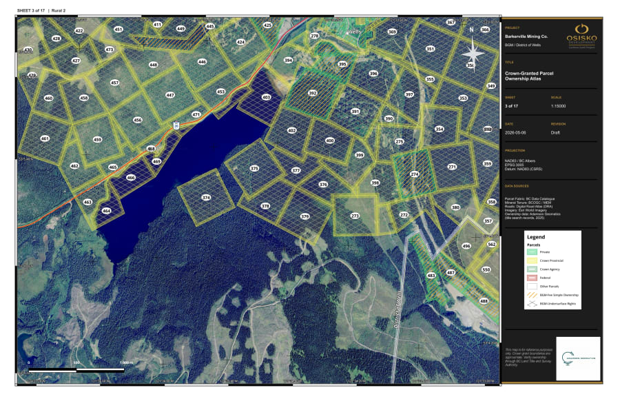
Barkerville Gold Mines Tenure & Ownership Map — Sheet 3

Wells / Barkerville, Cariboo Region, British Columbia

Detail sheet 3 of 5 of the Barkerville Gold Mines tenure and ownership map set, Wells / Barkerville, B.C.

View full size
View project
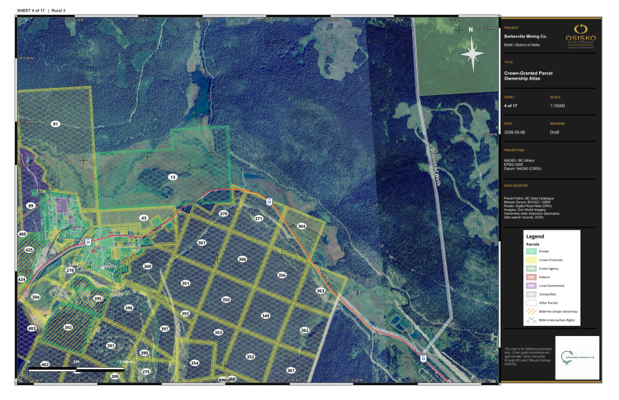
Barkerville Gold Mines Tenure & Ownership Map — Sheet 4View full size
SHEET 04/11
Mining Claim & Tenure

Barkerville Gold Mines Tenure & Ownership Map — Sheet 4

Wells / Barkerville, Cariboo Region, British Columbia

Detail sheet 4 of 5 of the Barkerville Gold Mines tenure and ownership map set, Wells / Barkerville, B.C.

View full size
View project
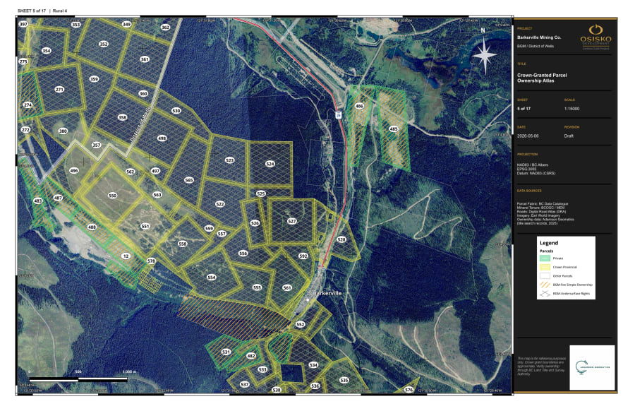
Barkerville Gold Mines Tenure & Ownership Map — Sheet 5View full size
SHEET 05/11
Mining Claim & Tenure

Barkerville Gold Mines Tenure & Ownership Map — Sheet 5

Wells / Barkerville, Cariboo Region, British Columbia

Detail sheet 5 of 5 of the Barkerville Gold Mines tenure and ownership map set, Wells / Barkerville, B.C.

View full size
View project
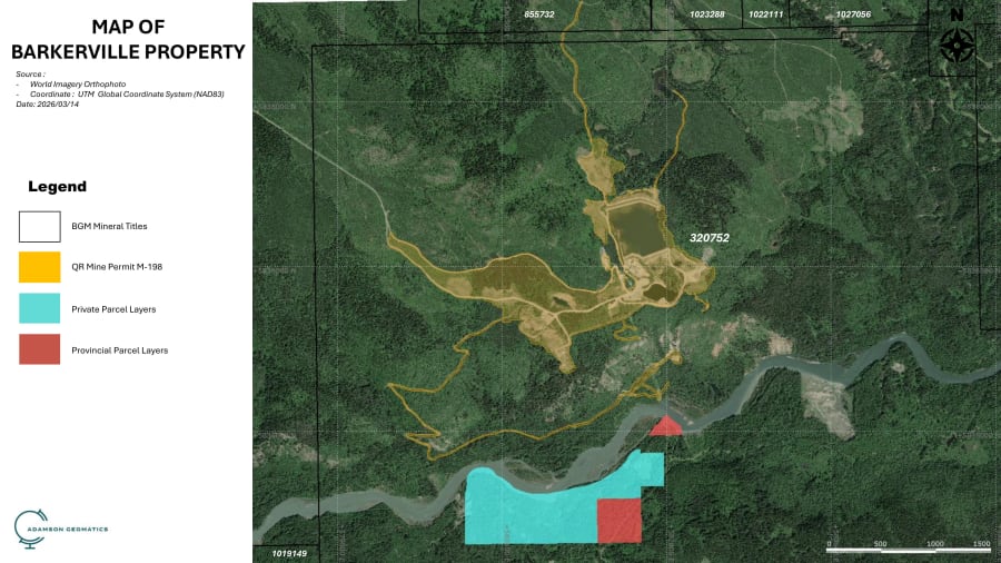
Barkerville Claim Map (March 2026)View full size
SHEET 06/11
Mining Claim & Tenure

Barkerville Claim Map (March 2026)

Barkerville, Cariboo Region, British Columbia

Mineral claim map of the Barkerville area, prepared for clients to identify prospecting targets.

View full size
View project
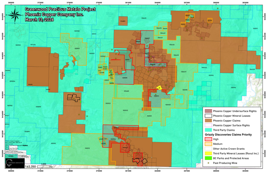
Greenwood Precious Metals Project — Land Tenure MapView full size
SHEET 07/11
Mining Claim & Tenure

Greenwood Precious Metals Project — Land Tenure Map

Greenwood, Boundary District, British Columbia

Land tenure map prepared for Phoenix Copper Company Inc. (March 2026): Phoenix Copper claims, mineral leases, surface and undersurface rights, third-party claims and crown grants, with Grizzly Discoveries claims ranked by priority and past producing mines.

View full size
Open PDF
California Lode Claim Geology Map — Township 9N, Range 4WView full size
SHEET 08/11
Geological Maps

California Lode Claim Geology Map — Township 9N, Range 4W

Mojave Desert, San Bernardino County, California

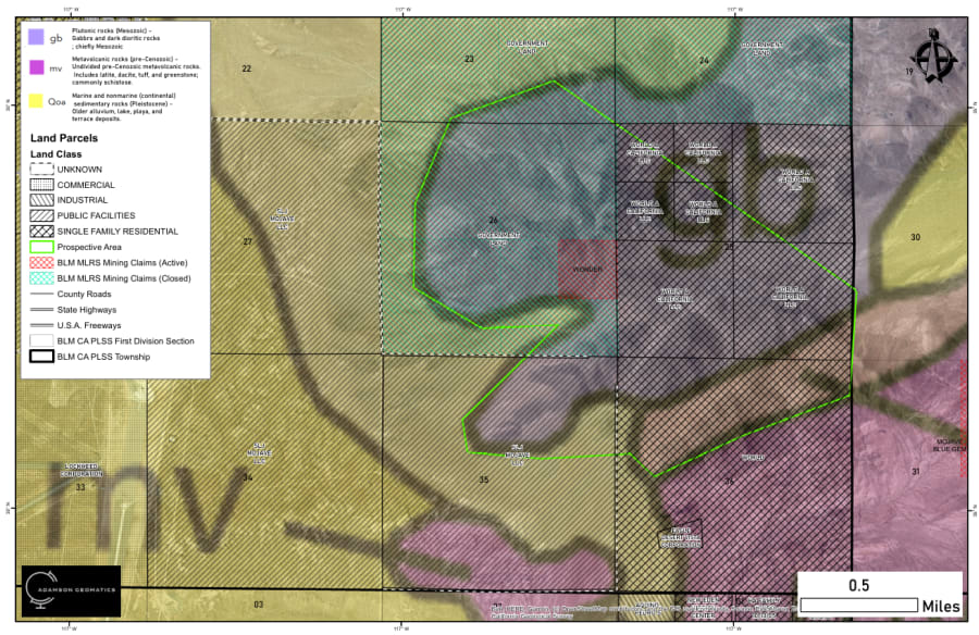
Geology map for lode claim targeting in the Mojave Desert: geological units (Mesozoic gabbro, pre-Cenozoic metavolcanic rocks, Pleistocene alluvium) over land parcels by land class, active and closed BLM MLRS mining claims, PLSS sections and the prospective area.

View full size
Green Mountain Lode Claims — Geology & Claim LayoutView full size
SHEET 09/11
Geological Maps

Green Mountain Lode Claims — Geology & Claim Layout

Mojave Desert, San Bernardino County, California

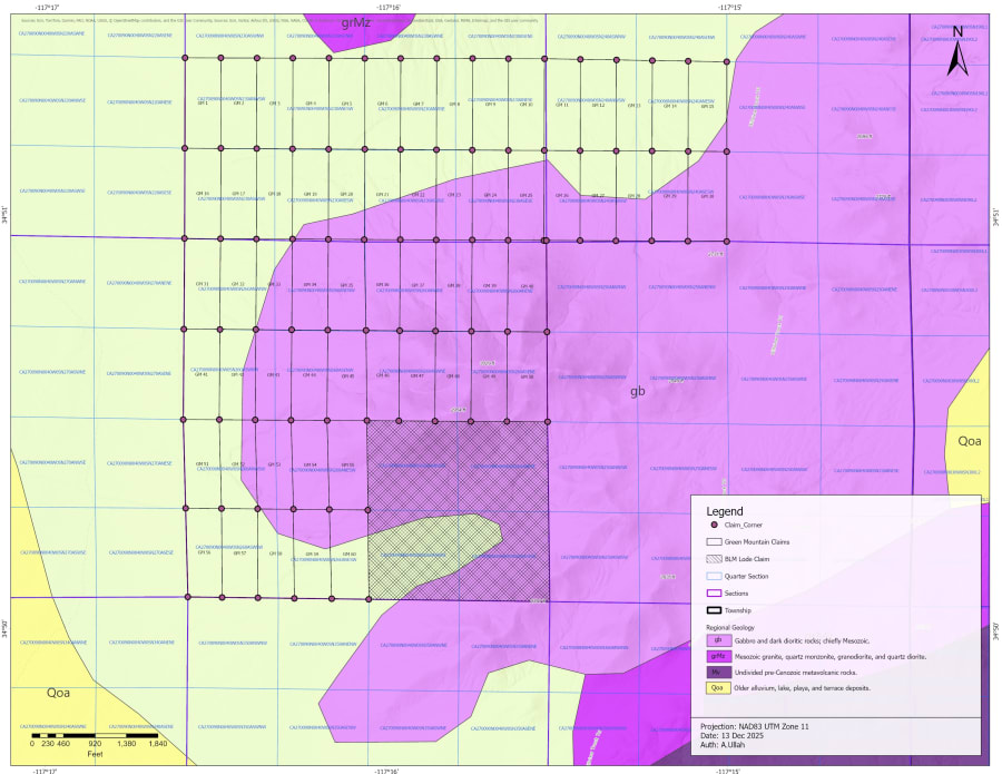
Claim layout of the 60 Green Mountain lode claims (GM 1–GM 60) with claim corners, an existing BLM lode claim, PLSS sections and quarter sections, over regional geology (Mesozoic gabbro and granite, pre-Cenozoic metavolcanic rocks, older alluvium). December 2025.

View full size
Greenwood Precious Metals Project — Tenure Good-To Dates (Monthly Report)View full size
SHEET 10/11
Mining Claim & Tenure

Greenwood Precious Metals Project — Tenure Good-To Dates (Monthly Report)

Greenwood, Boundary District, British Columbia

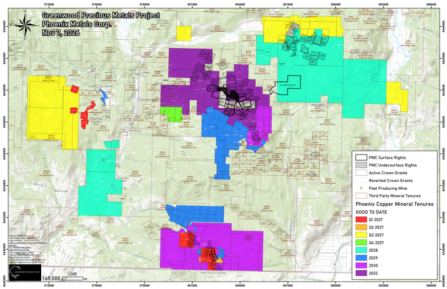
Monthly tenure report map for Phoenix Metals Corp. (November 2026): mineral tenures colour-coded by good-to date from Q1 2027 to 2032, with surface and undersurface rights, active and reverted crown grants, third-party mineral tenures and past producing mines.

View full size
Open PDF
Geological Map of San Bernardino — Iron Mountain PropertyView full size
SHEET 11/11
Geological Maps

Geological Map of San Bernardino — Iron Mountain Property

Helendale, San Bernardino County, California

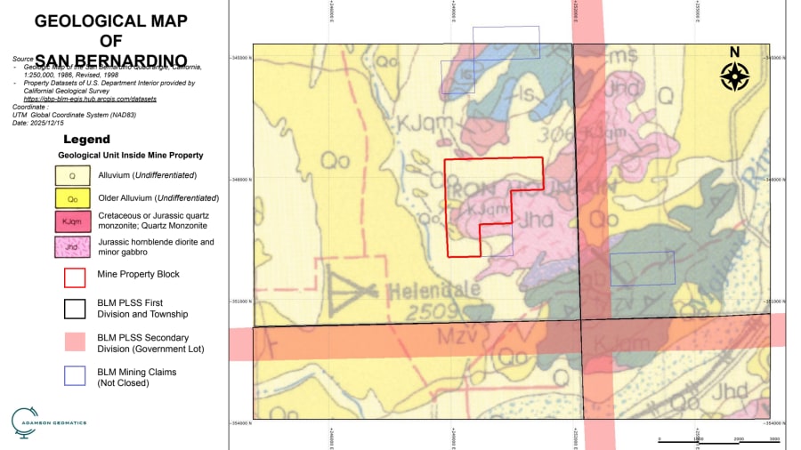
Geological units inside a mine property block on Iron Mountain near Helendale (quartz monzonite, hornblende diorite and gabbro, alluvium), with BLM PLSS townships and government lots and open BLM mining claims. Three views: plan, plan with contours, and an oblique 3D view looking east. December 2025.

View full size
Open PDF

Need a map like these?

Tell us about your property or project and we'll prepare a quote.

Request a quote