
Ferroux Property - British Columbia
Document Dossier Summary
EXECUTIVE CONTENT OVERVIEW
Select any section below to jump directly to detailed findings:
Property Overview
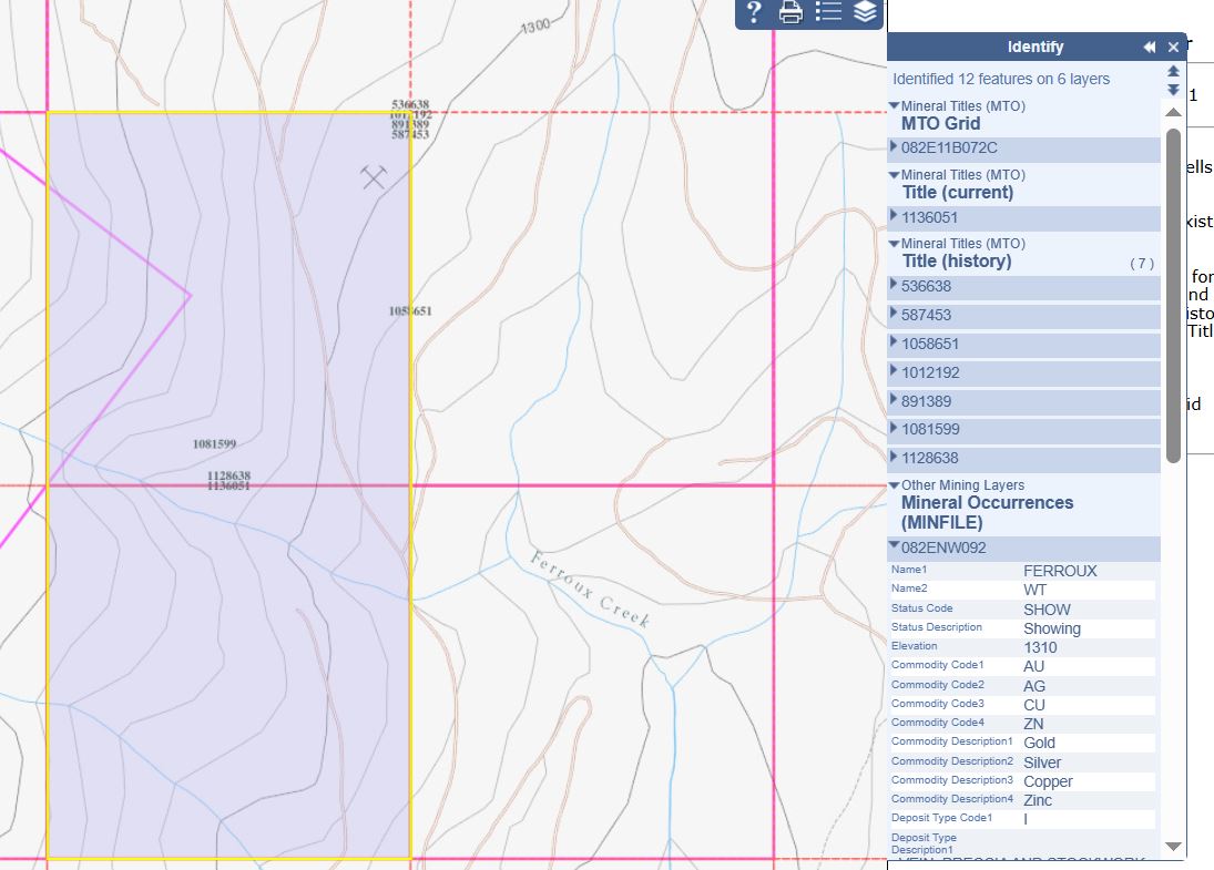
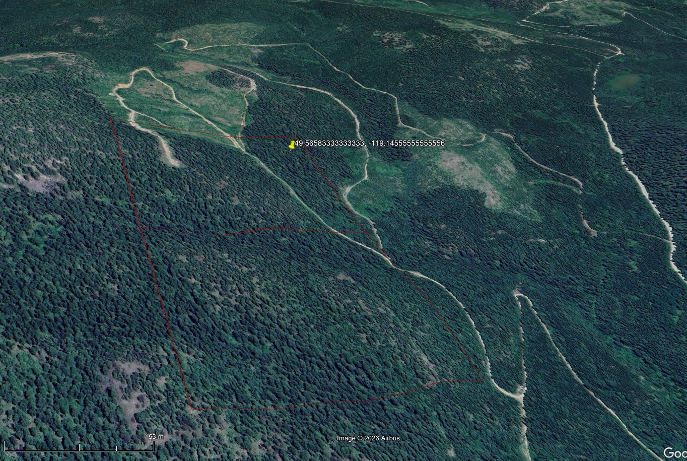
The Ferroux showing is located on a high-elevation ridge sitting between Saunier Creek and the West Kettle River valley, on the west side of Ferroux Creek, approximately 9.5 kilometres north-northwest of Carmi within the Greenwood Mining Division of British Columbia. Claim #1136051 covers 41.91 hectares and hosts a documented gold-silver-copper-zinc vein, breccia, and stockwork occurrence associated with a major north-south fault in the Ferroux Creek valley.
Claim Details & Geologic Context
- Name: FERROUX, WT
- Mining Division: Greenwood
- BCGS Map: 082E055 | NTS Map: 082E11E
- Status: Showing
- Latitude: 49.55861° N | Longitude: -119.15392° W
- UTM: Zone 11 (NAD 83), Northing 5492571, Easting 344860
- Commodities: Gold, Silver, Copper, Zinc
- Deposit Type: Intrusive-related vein, breccia and stockwork system
- Tectonic Belt: Omineca | Terrane: Plutonic Rocks, Overlap Assemblage
- Terrain: Moving up steeper ridge slopes, heavily forested with historical logging cutblocks scattered across the zone
- Adjacent Target: Arlington South Target (MINFILE 082ENW119) located right over the crest of the north-south trending ridge to the east
Capsule Geology & Structure
The property sits directly on the geologic contact line where Jurassic quartz diorite meets Carboniferous-Permian Anarchist Group chlorite-hornblende schists—a contact zone known for causing shearing that forms quartz-calcite veins containing gold, silver, and copper (chalcopyrite). The showing occurs in quartz monzonite of the Eocene Coryell Intrusions, underlain by granodiorite of the Cretaceous-Tertiary Okanagan Batholith and overlain to the north by dacite of the Eocene Penticton Group, Marron Formation. Mineralization is heavily concentrated along the north-south Ferroux Creek fault zone where it intersects smaller east-west cross-faults. Within and adjacent to these structural intersections, the host quartz monzonite is intensely brecciated, silicified, and features a prominent rusty weathering zone (gossan) containing up to 10% disseminated pyrite and minor pyrrhotite. Anomalous gold, silver, copper, and zinc assays are associated with these structural boundaries.
Exploration History
- Discovered in 1988 by Minnova Inc. through heavy mineral sampling techniques.
- Prospecting, geochemical and geological mapping programs followed by trenching in 1989 — 355 metres excavated across 9 trenches.
- Chip samples from the trenches were analysed for gold, silver, copper, lead and zinc.
- Exploration uncovered anomalous precious metal assays via trenching across the fault boundary.
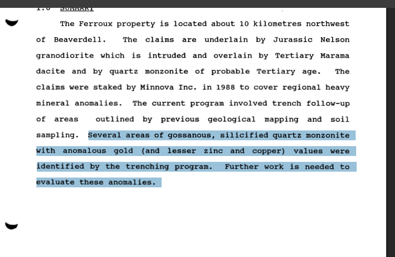
- Best precious metal values, from trench 89-B, were 0.72 g/t gold and 0.7 g/t silver, with lesser copper and zinc (Assessment Report 20070).
Tenure Status
- Title/Application Number: 1136051 — Mineral (M), Claim (C)
- Area: 41.91 hectares
- Mining Division: Greenwood | Map Number: 082E
- Issue Date: 2026/JUL/16 | Good To Date: 2027/JUL/16
- Owner: Christopher Adamson — 100%
Ferroux Property – Exploration Video
Field exploration and terrain overview footage for the Ferroux showing (Claim #1136051).
Ferroux Property – Field & Terrain Video
Field exploration overview and geological terrain footage.
Project Documentation
Quick Facts
- PropertyFerroux
- Claim Number1136051 (41.91 ha)
- Mining DivisionGreenwood
- MINFILE Number082ENW092 / 082ENW119
- StatusShowing
- CommoditiesAu, Ag, Cu, Zn
- Deposit TypeIntrusive-Related Vein, Breccia & Stockwork
- OwnerChristopher Adamson (100%)