
Back to Projects
Lundy Township, Ontario, Canada
Silverside Project - Lost Hope Mine
DOSSIER:Geological Potential
3
Document Dossier Summary
EXECUTIVE CONTENT OVERVIEW
Select any section below to jump directly to detailed findings:
Geological Potential
The Silverside property is situated in typical Cobalt Mining Camp geology and is highly prospective for intrusion-hosted magmatic sulphide (Cu-Ni-Pt-Pd) and vein-type Ag-Co mineralization. Past work has also revealed the potential to host diamondiferous kimberlite.
Exploration History & Data
- Identified by the Ontario Geological Survey's FOCUS program as having 'Very High' prospectivity based on data availability.
- Historic and modern exploration includes magnetic, VLF-EM, and UAV LiDAR/multispectral surveys.
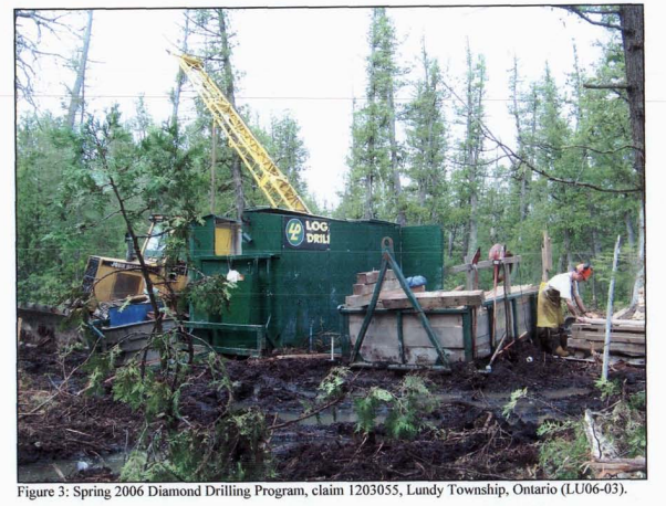
- 14 diamond drill holes and 11 assessment reports are on file in the data hot spot.
- A NI 43-101 Technical Report was prepared for Accend Capital in 2017 outlining multiple mineralized zones.
- Lost Hope Mine Ltd. completed detailed compilation, UAV mapping, and site visits in 2024 and 2025 to confirm visible alteration zones.
Property Maps & Active Drilling
IMAGE_GALLERY • 3 ITEMS
IMG 01
Spring 2006 Diamond Drilling Program
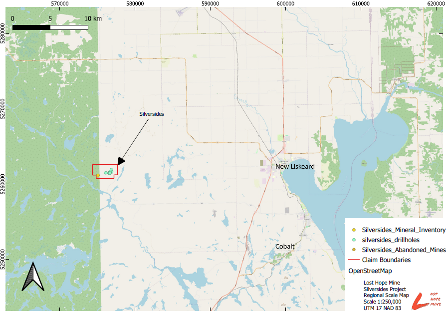
IMG 02
Regional Scale Map UTM 17
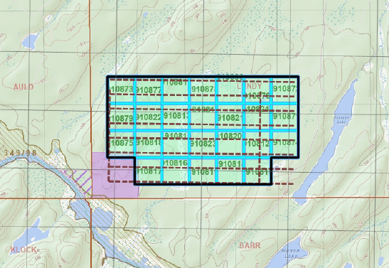
IMG 03
Tenure Grid Map
Quick Facts
- Project Size520 Hectares (26 claims)
- Primary CommodityCopper (Cu)
- Secondary CommoditiesAg, Co, Ni, Pt, Pd
- OGS Data Hot SpotKL28
- Abandoned Mine ID03587 (5 pits, 1 shaft, 2 adits)
Project Meta
AuthorAdamson Geomatics
DateNovember 9, 2026
Tags
CopperSilverCobaltNickelPlatinumPalladiumOntarioLost Hope Mine