
Back to Projects
Kirkland Lake, Ontario, Canada
Kirkland West Gold Project - Lost Hope Mine
DOSSIER:Geological Overview
3
Document Dossier Summary
EXECUTIVE CONTENT OVERVIEW
Select any section below to jump directly to detailed findings:
Geological Overview
Situated along the Cadillac-Larder Lake Break—a fault zone within the Abitibi Greenstone Belt famous for hosting massive gold deposits. Anomalous values of Gold (Au), Silver (Ag), and Copper (Cu) have been detected, highlighting significant geological features including quartz-feldspar veins and diabase dikes.
Recent Exploration & History
- Historical work by Preston East Dome Mines (1940s) and Noranda Co Ltd (1970s) identified shear zones and conductive zones of sulfides.
- In 2023, Lost Hope Mine Ltd. completed a preliminary geophysical program including ground-based EM surveys, line cutting, and soil/rock sampling.
- Samples analyzed by ALS Canada confirmed anomalous values in Au, Ag, and Cu.
- The property remains highly underexplored with no recorded drilling, offering excellent infrastructure and access for low-cost follow-up programs.
Regional Map
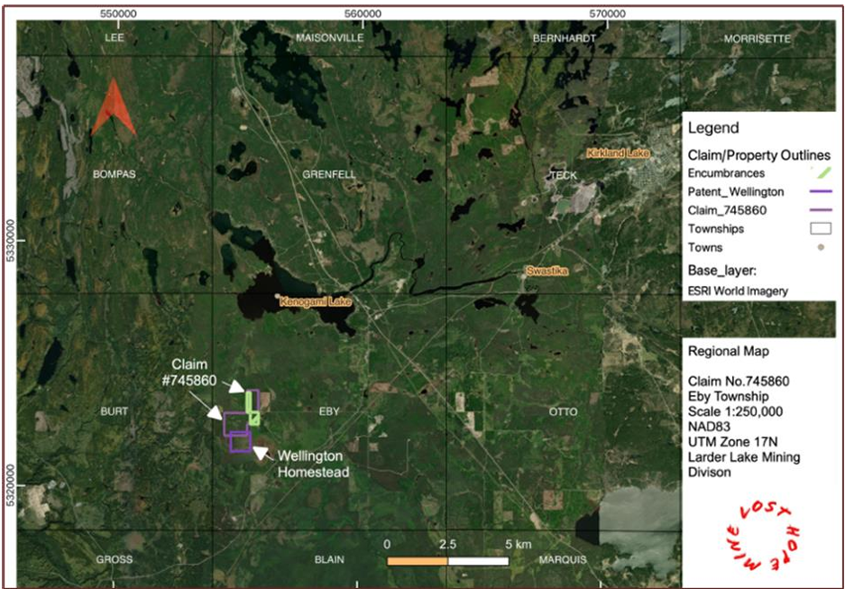
Regional map of the Kirkland West Gold project in Eby Township. // TODO: Insert screenshot from DS_LHM_Kirkland West Gold Project_022625.pdf
Quick Facts
- Project Size245 Hectares (8 cells + 65ha patented title)
- Primary CommodityGold (Au)
- Secondary CommoditiesSilver (Ag), Copper (Cu)
- Mining Claim IDs745860
- Geological SettingCadillac-Larder Lake Break
Project Meta
AuthorAdamson Geomatics
DateNovember 9, 2026
Tags
GoldSilverCopperAbitibi Greenstone BeltOntarioLost Hope Mine