

British Columbia
Résumé du dossier
APERÇU EXÉCUTIF DU CONTENU
Sélectionnez une section ci-dessous pour accéder directement aux détails :
Projets clients


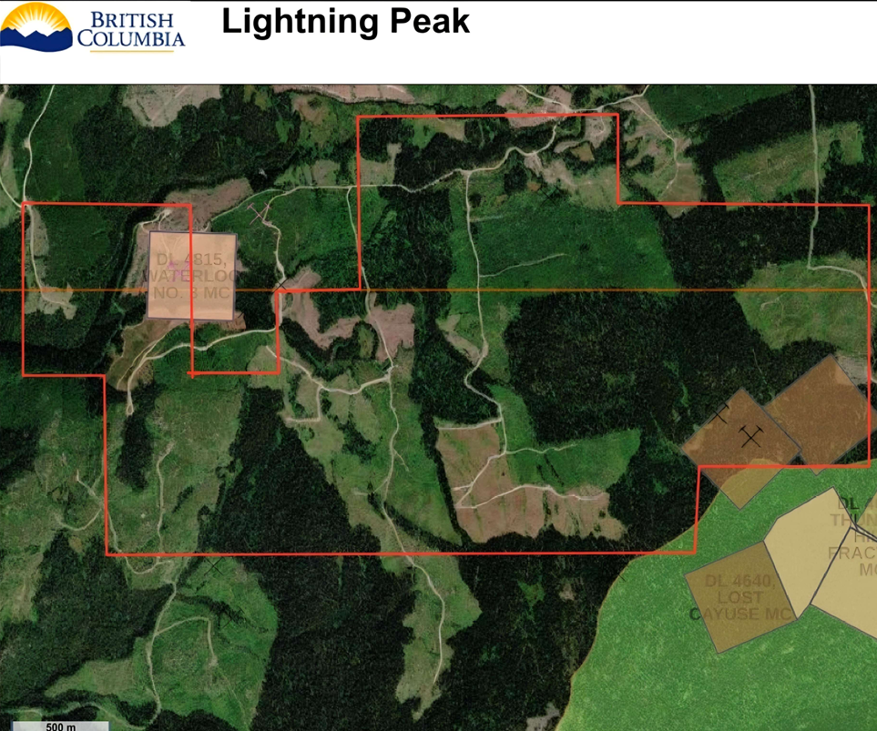
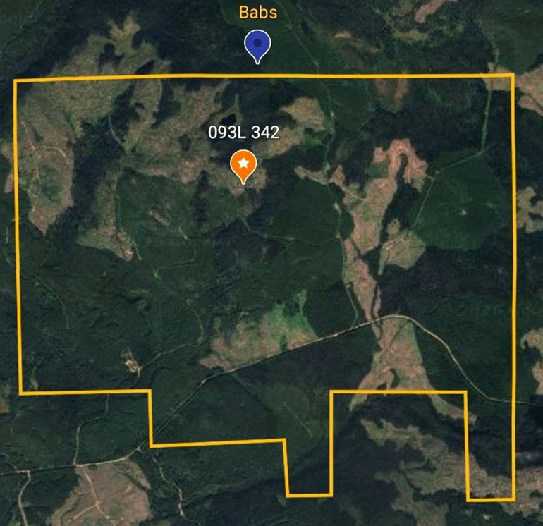

Goldin Rock Resources Inc. – Mount Burns Property
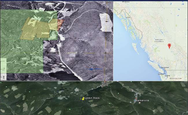
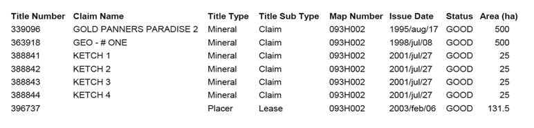
Prospective Burns Mtn area near Barkerville, B.C. * Full 43-101 Geological Evaluation Report available on request. * Straddles both north and south sides of Barkerville Hwy 26 between Stanley and Wells, B.C., sites of historic gold rush in the late 1800s to early 1900s. * Property includes 7 contiguous claims, all in good standing (MTO link).
Claim 339096 is located 3.5 km south-west of Barkerville Gold Mine's Cariboo Gold Project Cow Mountain Mine which is in feasibility stage (acquired by Osisko Development Corp. in 2018):
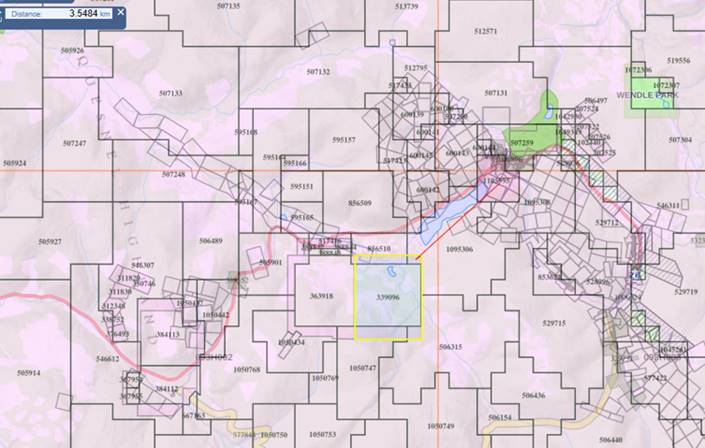
* 1,100 Hectares of hard rock mineral claims and 131 hectares of placer claims * Historical hard rock and placer gold finds on property * The subject site, Burns Mountain was the first hard rock mine in the 1800's and used a simple 5 stamp mill to crush rock and retrieve the gold in a small-scale operation. The north face of Burns Mountain has not been touched and is ready for productive mining. See report on this property's history, past exploration. Year-round access to Quesnel, major highways via Barkerville Hwy * US Listed Public Company in excellent standing can be included in package sale.
Golden Tiger Minerals – Tiger Property
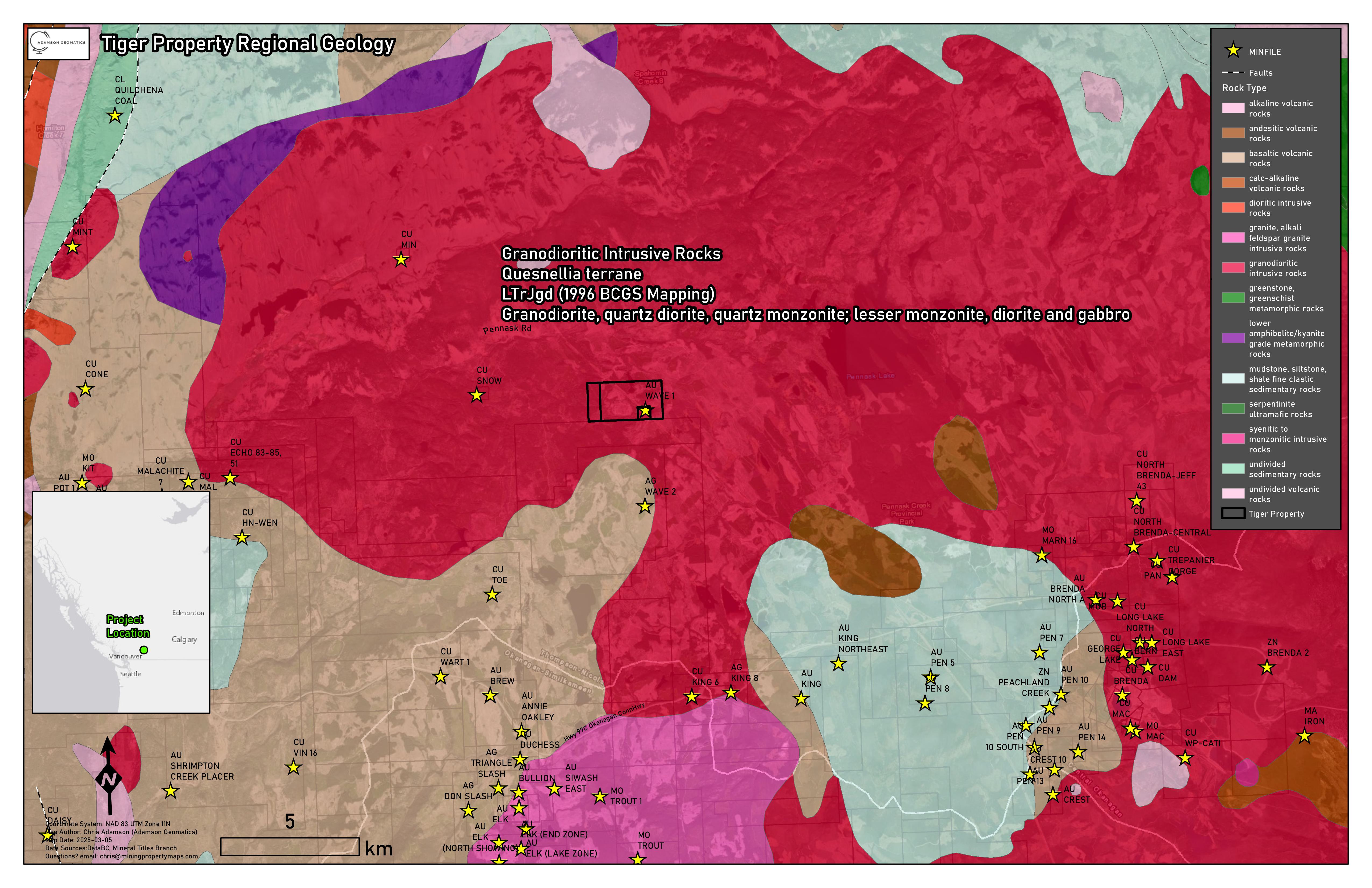
Gold and other precious metal potential. Mineralized quartz float and coincidental soil and stream anomalies were discovered on the property in 1991, samples of mineralized vein float up to 0.20 metres in size returning up to 8.23 g/t Au, 249.3 g/t Ag, 844 ppm Cu and 0.41% Pb. Click here to see presentation.
Golden Tiger Minerals – Sikanni Property
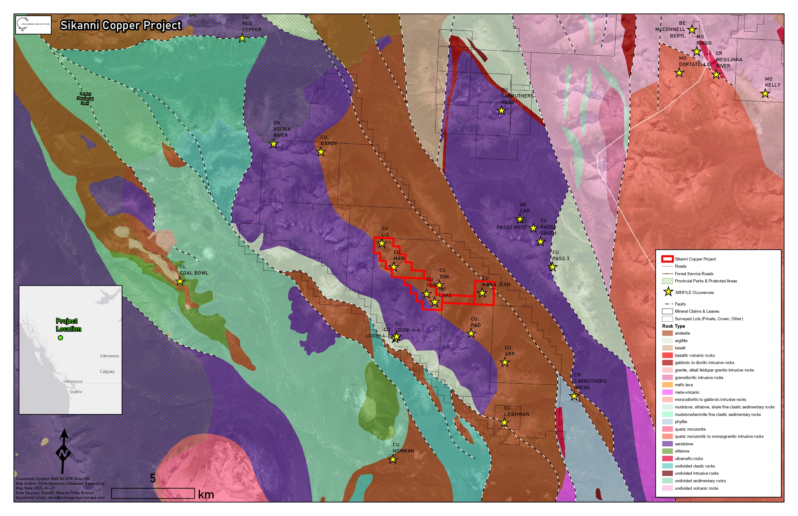
GOLDEN TRIANGLE AREA GOLD CLAIM! In 2021, grades from historical trenching included 4.87% Cu and 64.8 ppm Ag over 0.50 metres and a grab sample of 5.92% Cu and 53.1 ppm Ag.
Golden Tiger Minerals – Millar Property
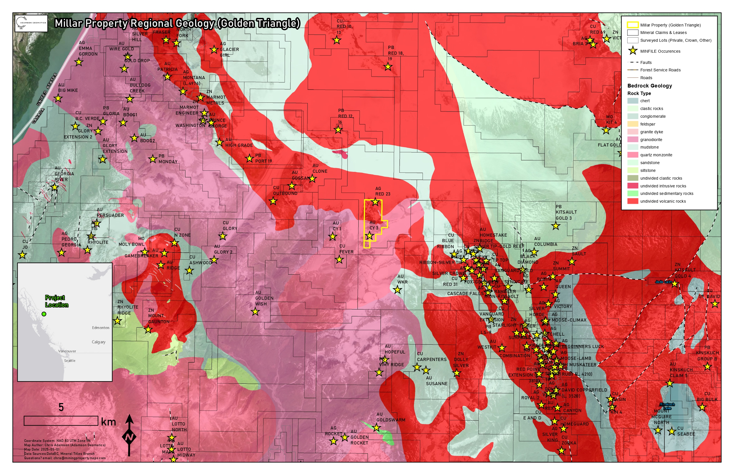
The CY 3 vein features a grab sample returning 2.97 g/t gold from a rusty, siliceous shear zone about 20 metres long, striking 250° with disseminated chalcopyrite and arsenopyrite throughout. The Red 23 showing is at the far north claim boundary. This showing is underlain primarily by the Hazelton Group of sedimentary rocks similar to the Eskay Creek package consisting of silicified black argillite with traces of pyrrhotite. The Red 23 showing is within an intense iron oxide alteration containing 3-5% pyrrhotite and pyrite with 1-3 mm wide quartz veinlets. Several projects in Golden Triangle and B.C Interior for sale
Placer Claim Mapping
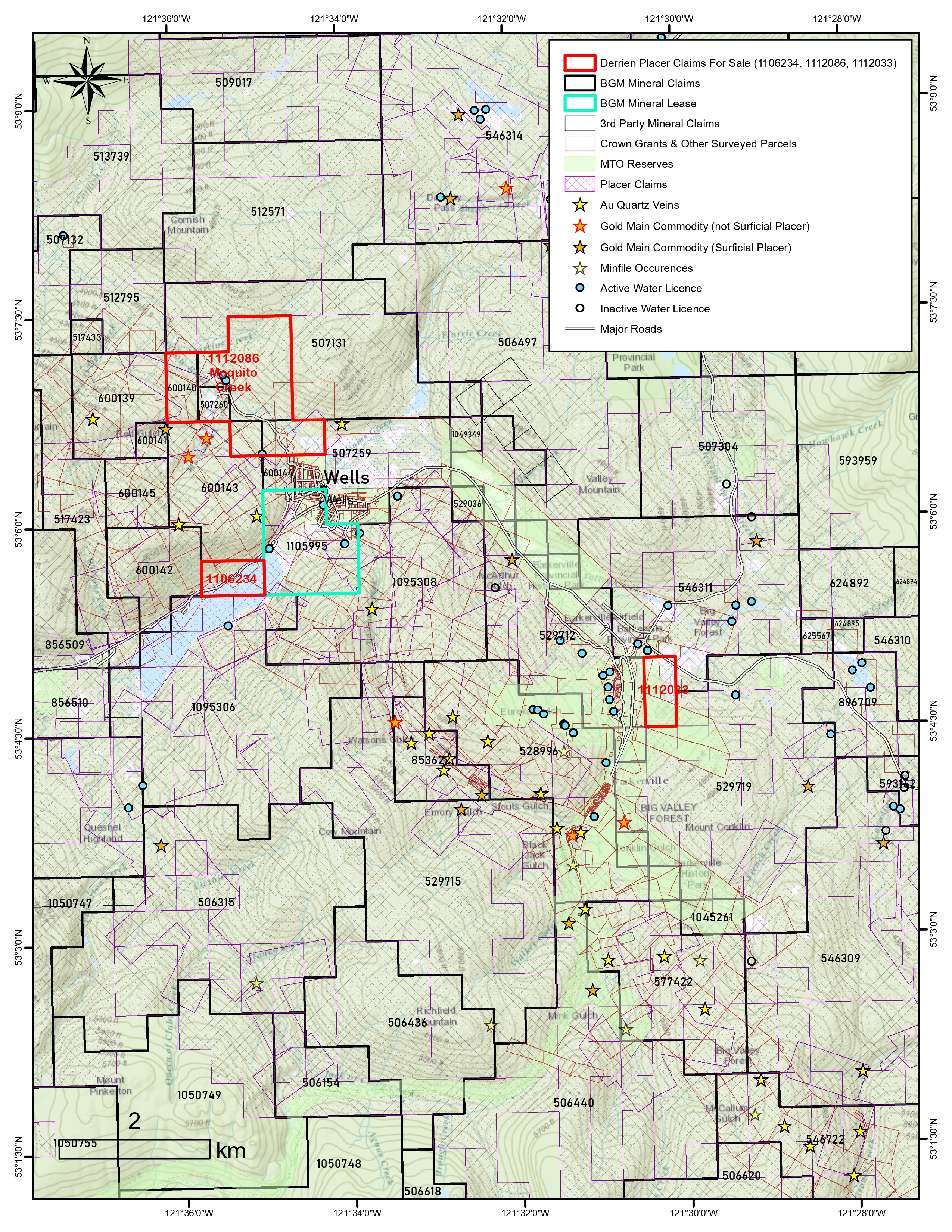
Wells / Barkerville, B.C – Cariboo Region
Surveyed parcel & mineral claim overlays
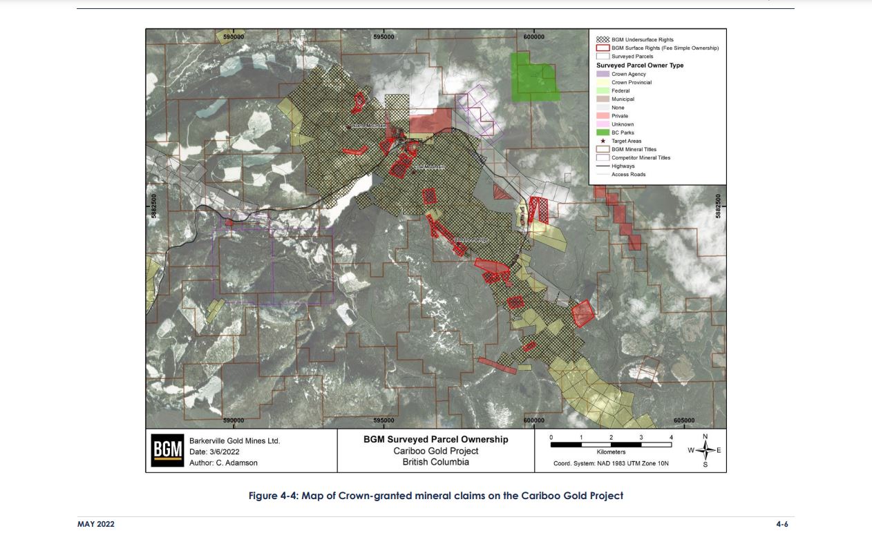
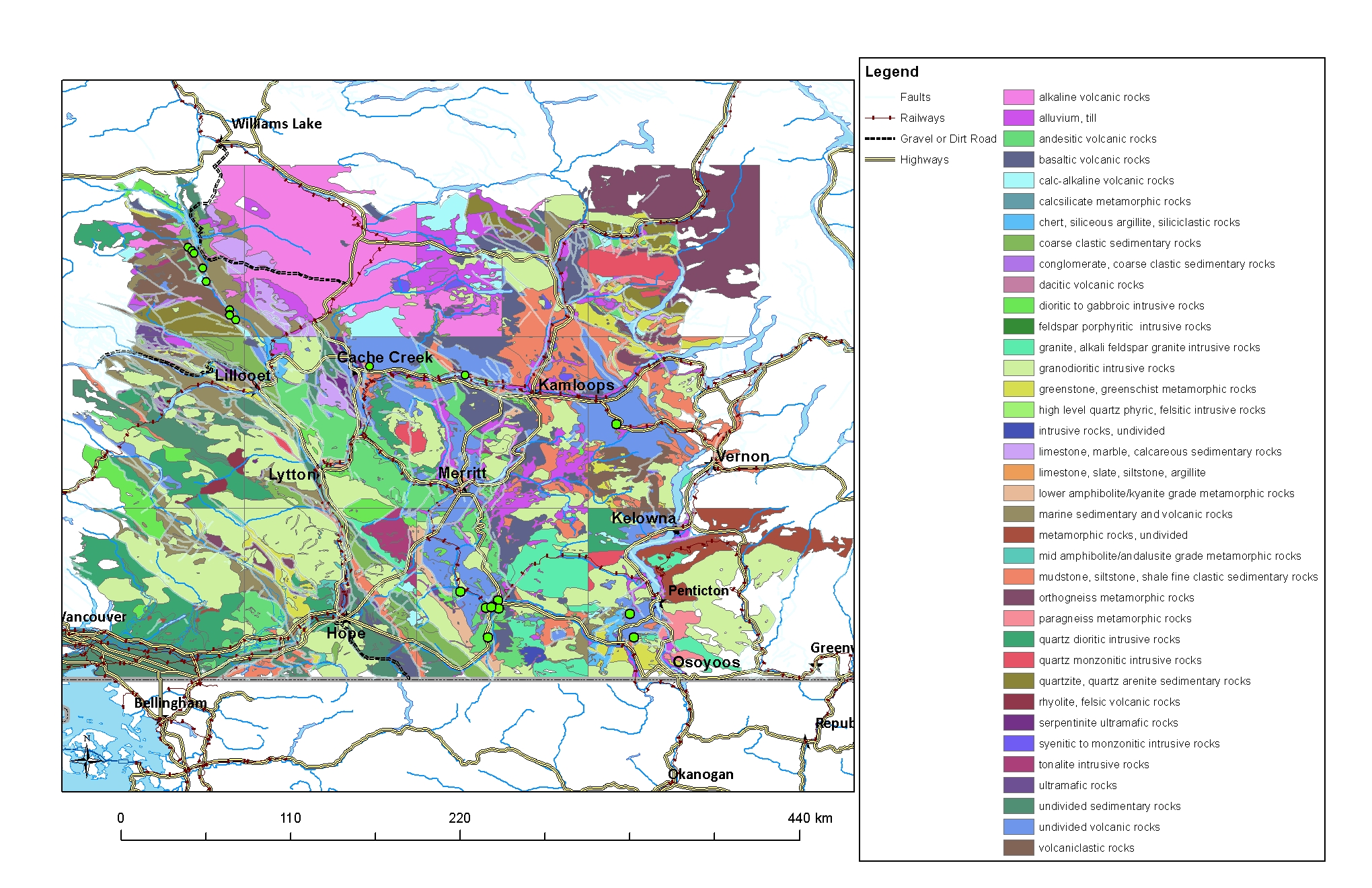
Remote Sensing / Satellite Imagery Analysis:
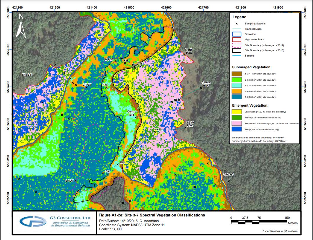
As well as mining property maps, Adamson Geomatics also creates advanced GIS maps for the forestry, oil and gas, transportation, utilities, infrastructure and environmental industries. Below are figures for the Whatshan Lake Vegetation Monitoring Reports for 2015 and 2016 that Adamson Geomatics completed for G3 Consulting Ltd. on behalf of BC Hydro. Transect mapping was conducted with a GPS, and bathymetry was produced from depth readings obtained from a sonar device. Depth data was processed in ArcGIS and sample points were overlaid. Image classification and NDVI analysis was conducted on satellite imagery.
Spectral Classification Maps
Remote Sensing — Spectral Analysis & LiDAR Sample Cases
Examples of Remote Sensing — Spectral Analysis (Sentinel Satellite Imagery) and LiDAR Digital Terrain Modelling (DTM) completed across British Columbia mineral occurrences: • NDVI derived from Sentinel Imagery (greener areas indicate healthier vegetation cover) — BC MINFILE 082JSW018. • Iron Oxide spectral analysis (Band Ratio B4/B2) derived from Sentinel Imagery (red areas highlight where iron oxide alteration is showing up strongest) — BC MINFILE 082JSW018. • Digital Terrain Model (DTM) derived from LiDAR for bare-earth structural and topographic visualization — BC MINFILE 093F 037.
Sentinel Spectral Analysis (NDVI & Iron Oxide) & LiDAR DTM
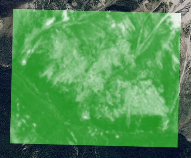
NDVI derived from Sentinel Imagery (MINFILE 082JSW018)
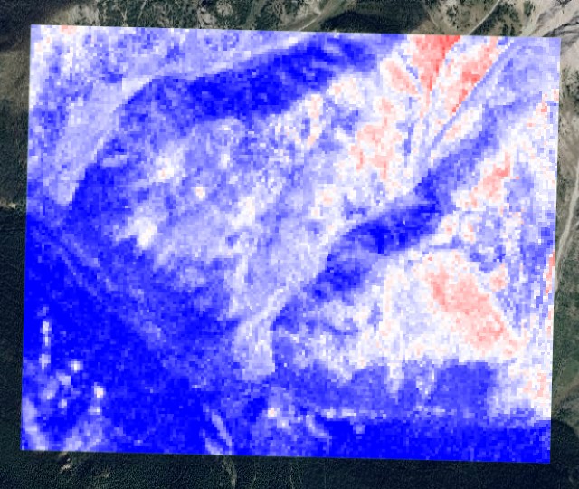
Iron Oxide Spectral Analysis (B4/B2) derived from Sentinel Imagery (MINFILE 082JSW018)
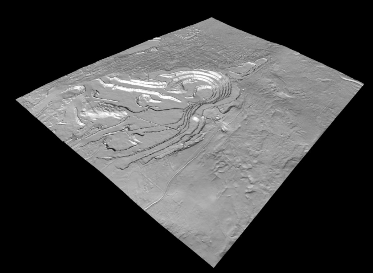
Digital Terrain Model (DTM) derived from LiDAR (MINFILE 093F 037)
Land Management & Land Development
Adamson Geomatics was the Land Manager for Barkerville Gold Mines (now owned by Osisko Development Corp) from 2017-2023.
Key accomplishments there included:
- Registering undersurface rights that were erroneously registered to another company in the name of the rightful owner, BGM. This resulted in gold rights being added to the area of the Cariboo Gold Project near Lowhee Creek covering an estimated 1 million ounces of gold!
- Negotiating the purchase of 4050 Bowron Lake Road (Ballarat 5F) and around ten other private properties in the town of Wells
- Correcting the mineral lease application for the Cow Mountain mineral lease, registering over 13 million dollars of work to the contiguous property block that would have been lost due to a third party contractor error.
Mr. Adamson has a Letter of Reference from Barkerville Gold Mines for my work there, and a recommendation from the President of the Company, Chris Lodder who says Mr. Adamson is the “best lands guy in the business”. Along with these accomplishments, Mr. Adamson led the development of major infrastructure projects for the Province of British Columbia and this mining company, including the cell tower and power line right of way projects. For more information, email chris@miningpropertymaps.com.
Little Fort Polymetallic Project – Video Overview
Aerial drone survey and site access footage for the Little Fort Polymetallic Claim (#1106809).
Little Fort Polymetallic Claim – Drone Survey & Site Access
Aerial perspective, outcrop geology, and terrain survey for Little Fort Polymetallic Claim #1106809.
Residential & Rural Real Estate – British Columbia
Looking for B.C Real Estate? We work with several realtors, mortgage brokers and surveyors. We can direct you to knowledgeable professionals with proven track records no matter what your B.C Real estate needs are. This includes non mining properties such as vacant rural land, which Adamson Geomatics specializes in, and also residential real estate throughout B.C - for which we refer clients to our partner realtors. For clients who prefer to buy direct from owner, Adamson Geomatics has closed over a dozen residential and commercial purchase and sale agreements and can assist with review of property disclosure statements, title searches, survey plans and order land title documents and submit Land Title Office forms. Note a notary would be required to sign off.
Points clés
- PropertiesMultiple
- CommoditiesAu, Cu, Ag, Pb, Zn
- ServicesGIS, Land Management, Mapping