

Geomatics / GIS
Precision GIS &
Land Management.
Expert geospatial consulting for mineral exploration, land management, and real estate services across Canada, the USA, and internationally.
Project
Portfolio
Active regions, available properties, and featured cartography from the Adamson Geomatics project archive.


List Your Property &
Promote Your Business
Choose the listing model or company membership package that fits your goals. From zero-upfront commission options to flat-rate unlimited listing subscriptions.
Commission-Based Listing
List your property for free. We handle marketing and technical exposure, earning a commission only when a successful sale completes.
- No upfront listing fee
- Full marketing & property exposure
- Technical GIS map & dossier setup
- Commission paid only upon successful sale
- Standard buyer inquiry routing
Subscription Listing
Keep 100% of your sale proceeds with a flat monthly listing fee. Full control over photos, maps, PDFs, and seller contact details.
- Keep 100% of sale proceeds (0% commission)
- First month completely FREE
- Edit & update listing details anytime
- Photos, spatial maps, PDFs & contacts included
- Direct buyer inquiries routed to you
Company Membership
Comprehensive branding and unlimited listings for junior mining companies, prospectors, consultants, and land developers.
- Dedicated Company Profile page & logo
- Direct link back to your company website
- Unlimited property & claim listings
- Featured exposure across registry & map search
- Direct client lead & inquiry distribution
- First month completely FREE
Who Benefits Most From Subscription Listings?
Full company profile, logo, website backlinks, & unlimited asset listings.
Showcase mineral claims to active buyers with 0% sales commission options.
Promote expert advisory services and land records investigation capabilities.
Showcase multi-unit residential, commercial, or vacant land portfolios.
Accomplishments & Case Studies
Real-world projects often require more than research alone. By combining GIS analysis, land records, survey interpretation, valuation expertise, and technical investigation, we help clients solve complex property, land, and resource-related challenges.
The following examples highlight some of the projects and outcomes that have been successfully delivered.
Land Expropriation Support
Assisted a client during a land expropriation matter involving the Province of British Columbia. Through detailed research, documentation review, and property analysis, the case was successfully resolved, helping the client retain privately owned land.
- >Land research and analysis
- >Property documentation review
- >GIS and mapping support
- >Evidence preparation
Property Assessment & Tax Appeal Successes
Successfully supported multiple property assessment and tax appeal cases throughout British Columbia. Using property valuation research, GIS-based comparison analysis, and assessment review techniques, evidence was prepared to challenge assessed values and support fair property taxation outcomes.
- >Property valuation analysis
- >BC Assessment appeals
- >Tax appeal support
- >GIS-based comparable property studies
ParcelMapBC Location Correction
Identified a mapping discrepancy involving the Barlow Substation in the Quesnel area. Through GIS analysis, georeferencing, and detailed review of historical survey plans, the location inconsistency was documented and corrected, improving the accuracy of property and infrastructure mapping records.
- >GIS analysis
- >Survey plan interpretation
- >Georeferencing
- >Parcel correction research
Residential Property Due Diligence
Provided research and due diligence support for numerous residential property transactions in the Barkerville and Cariboo regions of British Columbia. Services included reviewing property records, analyzing disclosure information, researching ownership details, and identifying potential concerns before purchase decisions were finalized.
- >Property Disclosure Statement reviews
- >Property research
- >Ownership verification
- >Due diligence investigations
Mineral Property & Exploration Support
Supported mineral exploration projects, prospectors, and resource companies through claim research, GIS mapping, technical reporting, and land package evaluation. Projects have included tenure research, claim staking support, geological mapping, and the preparation of technical materials used for exploration planning and project advancement.
- >Mineral claim research
- >Exploration mapping
- >Geological data integration
- >Technical reporting
- >GIS analysis
Trusted by Explorers,
Industry & Universities
Precision GIS mapping, Crown Grant parcel research, tenure management, and terrain modeling delivered for major mining corporations, public utilities, municipalities, and academic research institutions.

University of Victoria
Helped connect their geology team with tour of Phoenix pit

Barkerville Gold Mines
100+ km powerline right-of-way GIS land mapping and complex Crown Grant transfers

JDS Mining
Ground-truth GIS mapping and operational support for major mineral exploration assets

B.C. Hydro
Reservoir monitoring reports & watershed spatial analysis across British Columbia

Dentons LLC
Complex Crown Grant transfers, historical parcel boundary research, and title mapping

University of Waterloo
Wildfire mitigation modeling consulting and terrain risk evaluation

Quantum Critical Metals
Exploration GIS mapping, tenure research, and investor presentation geospatial assets
The City of Coquitlam
Produced stream monitoring maps in partnership with B.C Hydro
Browse all 21+ documented client engagements, consulting projects, and institutional partnerships.
Global Telemetry
Certifications
Industry-recognized qualifications in geospatial analysis and mining technology.
Esri Certification
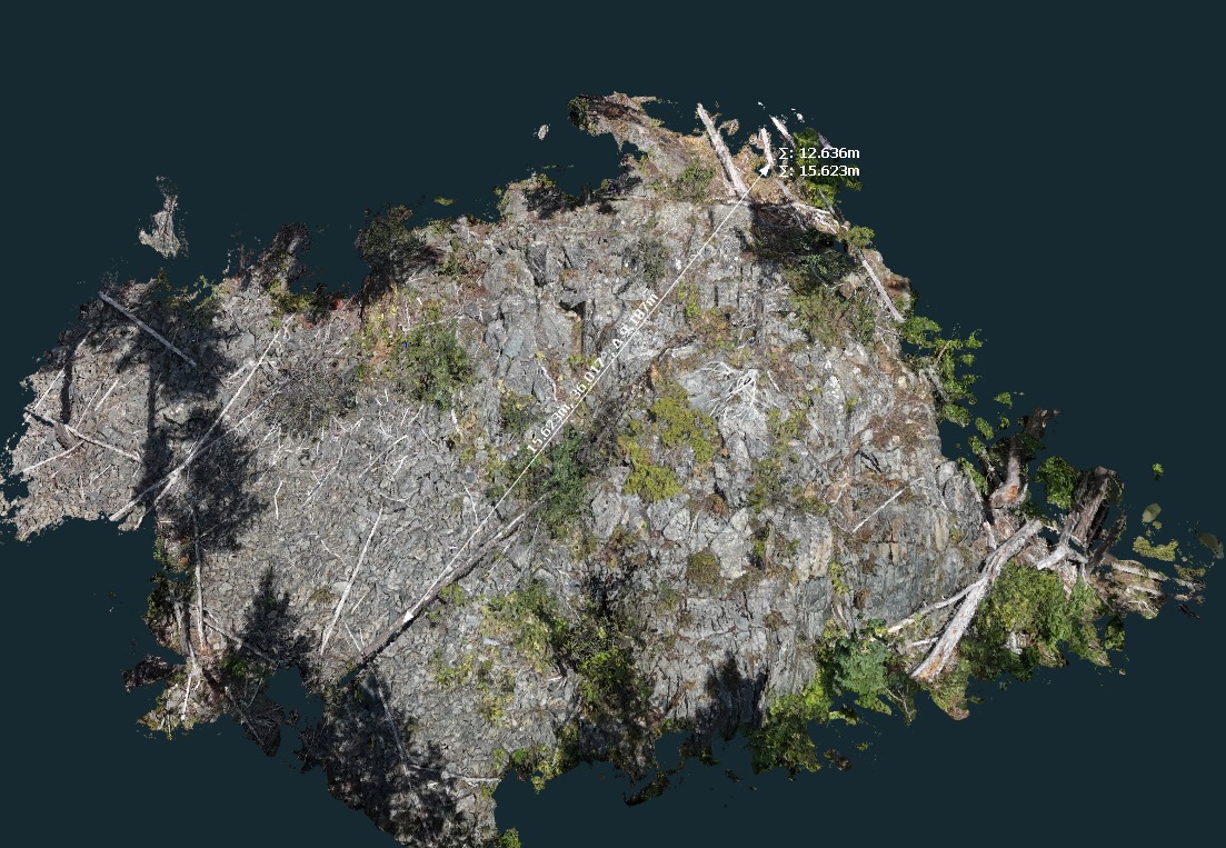
Esri video screenshot showing Jack Dangermond's Plenary Presentation at the 2025 Esri User Conference, featuring Chris's image submission
Esri Certification
Field
Reports
Endorsements from executives, geologists, and industry leaders. Verified intelligence.
"I have had the opportunity over the last several years to work closely with Chris on a number of matters, some of which were very complex in nature and required a careful analysis of the approach to take in order to achieve the desired result. He is very..."
"Hi Chris, Congratulations on having your image selected for the 2025 Esri User Conference! Your image was displayed in Jack Dangermond's Plenary Presentation. Well done! We would like to sincerely thank you for your work and look forward to your future submissions."